New Barbados Stamps – Gullies in Barbados
Barbados Postal Service issued a new series of stamps on 15th April 2024 entitled ‘Gullies in Barbados’. This brand new set of definitives is intended to replace ‘The Builders of Barbados’ series which was initially issued on 18th January 2016 (SG1435-1448) and has now been in circulation for the past eight years. This set was long overdue as I originally wrote about their imminent arrival back in 2022, but several reasons, (the turbulence the world went through during Covid being a large part of it) meant their launch was delayed until now.
At first glance though, it was worth the wait.
The set comprises just eleven values, replacing the fourteen values in the previous set, with some new values representing well used rates, and some values removed. The following table summarises the changes:
| Value | Builders of Barbados | Gullies in Barbados |
|---|---|---|
| 5c | Y | |
| 10c | Y | Y |
| 25c | Y | Y |
| 60c | Y | |
| 65c | Y | Y |
| $1.00 | Y | Y |
| $1.40 | Y | |
| $1.50 | Y | |
| $1.80 | Y | Y |
| $2.00 | Y | |
| $2.20 | Y | Y |
| $2.50 | Y | |
| $2.75 | Y | |
| $3.00 | Y | |
| $5.00 | Y | Y |
| $10.00 | Y | Y |
I’m very surprised by the omission of the 5c value as the cover used to send the set to me used a 5c make up rate, and I can imagine a great many cases where this value would be used.

The set seems, at first glance, a little abstract. It focuses predominantly on the plants and trees found in the gullies, except for a bridge shown on the 10c value. In fact, it doesn’t actually show a gully anywhere on the set, but as we will see, the planning for this set means it doesn’t need to.
The stamps are accompanied by a lavish twenty page booklet, produced by the Philatelic Bureau, which contains a wealth of information about gullies and the details of every plant featured on the stamps. If you want to know more about any of the subjects featured in this set then this booklet is a must.
As with the last definitive set, as far as I can see this information is not available anywhere online, so I am going to reproduce it below. Please be aware that this information is taken directly from the booklet and remains the copyright of the Barbados Postal Service and/or the Barbados Philatelic Bureau. As always though, I will add any relevant links I can find to other online resources that may give you even more information.
What are Gullies?
Gullies are the winding, branching ravines in the coral cap which mainly run from the central higher regions of the island towards the coast. These were once caves with underground streams, the roofs of which have long since collapsed. Gullies are generally considered part of the network of natural drainage channels in Barbados.
Gullies are a moist environment which supplies water for the growth of large trees, shrubs, vines, herbs, animals, insects and fungi. They are an integral part of Barbadian cultural heritage and have natural values. These values stem from their exceptional beauty, unique biodiversity, variety of habitats and wildlife.
Gullies were the boundaries between sugar plantations. During the heyday of the sugar industry, they were periodically cleared for firewood and agricultural workers even collected the soil that had washed in the gullies and returned it to the sugar plantations.
In Barbados, gullies tend to be ‘U’-shaped, with steep sides and relatively broad, flat bottoms, usually averaging between 6 m (20ft) to over 30 m (100ft) in depth. These features are frequently densely wooded and often dry, except during periods of heavy rainfall.
The Gullies of Barbados create numerous complex networks (or corridors) which extend over most of the island and are estimated to be approximately 460 (286 miles) in length. Most gullies are composed of vertical walls, caverns, sloping slides and floors which allows them to support a rich variety of plant life. Today, the protection and conservation of gullies are important because many Bajan native species seen only in the gully are threatened or endangered. Some of these plants were used historically as food, firewood, medicine, tools and materials for basketry.
The Gullies chosen for this Definitive Issue are only a representative few of the many sites around the Island.
Blackmans Gully and Bridge – 10c and $5.00
10c
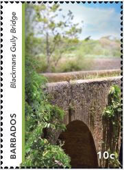
Blackmans Gully Bridge 10c, $5.00 Blackmans Gully and Bridge
Blackmans Gully and bridge is one of the more unique gullies in Barbados because this gully also has a bridge as a major feature. This gully is located in the parish of St. Joseph on the eastern part of the island well known for its surfing and beach activities.
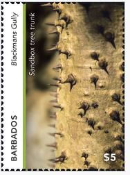
Blackmans gully is part of an island-wide series of gullies that form a vital part of our ecosystem. The gullies are home to many animals, including the Green Monkey, along with a wide range of plants some of which have medicinal value and large trees such as the Sandbox Tree (hura crepitans) known for its huge, spiny trunk.
$5
Overlooking the gully is Blackmans Bridge which dates back to before 1682. The bridge is between 35 and 40 metres long and 3 and 5 metres wide.
During this era, the gully and bridge were used to keep the inhabitants of some of the neighbouring villages of Bonwell, Easy Hall, Castle Grant and Coffee Gully in St. Joseph along with Venture, Orange Grove and Wilson Hill in St. John connected. The bridge was constructed with limestone boulders. These were plastered together with a white lime and sand mixture, molasses and egg whites were also added to the mixture. These ingredients were strong enough to hold this bridge together for over three hundred years.
Russia Gully – 25c and $1.80
25c
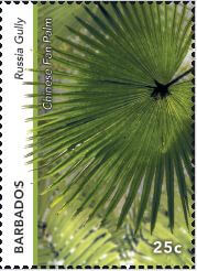
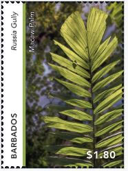
Russia Gully is located in the parish of St. Joseph, between Fisherpond and Lammings. This gully named after a nearby plantation called Russia in the 1650s, is one of the many luxuriant gullies in the centre of the island. It is very deep, yet the highway runs through the bottom, so it is more easily explored than most.
Many trees can be found in this gully, with silk cotton and other large trees, local wild plants, ferns, and palm species such as the Chinese Fan Palm (Livistona Chinensis) and the native Macaw palm (Aiphanes minima) with its trunk covered in thick long needle-like spines.
$1.80
Welchman Hall Gully – 65c, $1.00, $2.20 and $10.00
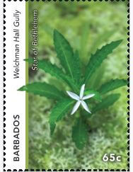
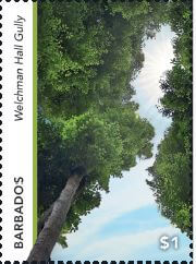
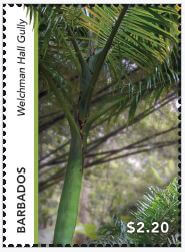
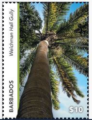
Welchman Hall Gully located in the parish of St. Thomas, was first described more than 200 years ago as “a fine valley of fruits which offered the most grateful refreshment”. The original owner, a Welshman called General William Asygell Williams, who came to Barbados in 1650, planted the orchard and its famous nutmeg grove. Both are still there, despite the passing of Hurricane Elsa in 2021, which knocked down some of the old nutmeg trees, allowing new ones to grow. In 1962, Barbados National Trust bought the Gully and opened it up as a visitor attraction.
Welchman Hall Gully is a tropical forest in a collapsed cave. It is part of the upper structure of Harrison’s Cave and there is still evidence of the collapse. Walking through the Gully, you will still see stalagmites, stalactites and a couple of huge columns. When Harrison’s Cave was rediscovered in the 1970s, explorers entered it through a hole in the floor of the Gully. The gully has a variety of plants and trees, including the Cabbage palm (Roystonea oleracea), nutmeg trees and the Star of Bethlehem.
65c

$1.00
$2.20
$10.00
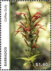
Coffee Gully – $1.40
Coffee Gully in the parish of St. Joseph is located off Highway 3A, east of Industry, south of Branchbury and west and north of Blackmans. The gully is central to the gully network which traverses the parish from Horse Hill to Bushy Park and is spanned by several bridges, including the Egg and Molasses Bridge (Blackmans Bridge). It is presumed that the gully’s name was derived from the presence of two varieties of wild coffee, shrubs that usually flourish on the gully floor.
This gully has many varieties of plants, trees and shrubs such as the Blood root (Justicia secunda) which can be used to make a cooling tea and a bath for soothing skin rashes.
$1.40
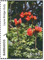
Layne Bridge Gully – $1.50
Layne Bridge Gully in the parish of St. Joseph, is located along Highway 3A near Sugar Hill. The name apparently derives from the Lane family, which owned the neighbouring Castle Grant plantation from the 1820s until the 1860s. The gully provides a unique glimpse into the island’s diverse ecosystem. Surrounded by lush tropical vegetation and some wildlife, the dense canopy provides a serene and shaded retreat from the sun, inviting nature enthusiasts and avid hikers to explore nature’s wonders. Many tall and large trees can be found in the gully, such as the vibrant flowering African Tulip tree (Spathodea campanulata).
$1.50
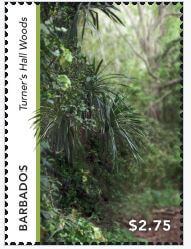
Turner’s Hall Woods – $2.75
Turner’s Hall Woods named after its previous owner Captain John Turner, is located in the parish of St. Andrew. Situated on a steep slope, facing northwest, and thus somewhat protected from full exposure to wind and sun. It is approximately 220 hectares/540 acres, at an elevation of 600 to 800 feet above sea level. The woods stand on oceanic clay soils and are about a mile and a half in length by 300 yards in width. Turner’s Hall is the last true forest remaining in Barbados and indicates what the island would have looked like when the first settlers arrived. With over one hundred (100) species of flowering plants, nearly all native species, it is the most species-rich site on the island. Some of the plants in this relic forest are found nowhere else in Barbados. This wood is classified as a semi-evergreen seasonal forest consisting of mainly broad-leaved evergreen trees with some foliage reduction in the dry season.
There is diversity of trees in both its lower and upper layers. The upper layer at 70 to 100 feet above ground level, is a sparse, open canopy of mainly deciduous trees. The second, lower layer ranges from 35 to 65 feet above ground level. This layer is much more dense than the upper canopy, consisting of mainly evergreen species and a few deciduous trees. Turner’s Hall Woods is also important as a drainage tributary from the Bruce Vale River, which traverses the site.
$2.75
First Day Covers
There are two First Day Covers issued with this set, as the entire set will not fit easily onto a single cover. The low values are on a cover featuring the Sandbox Tree, taken in Russia Gully and the high values feature Layne Bridge Gully.
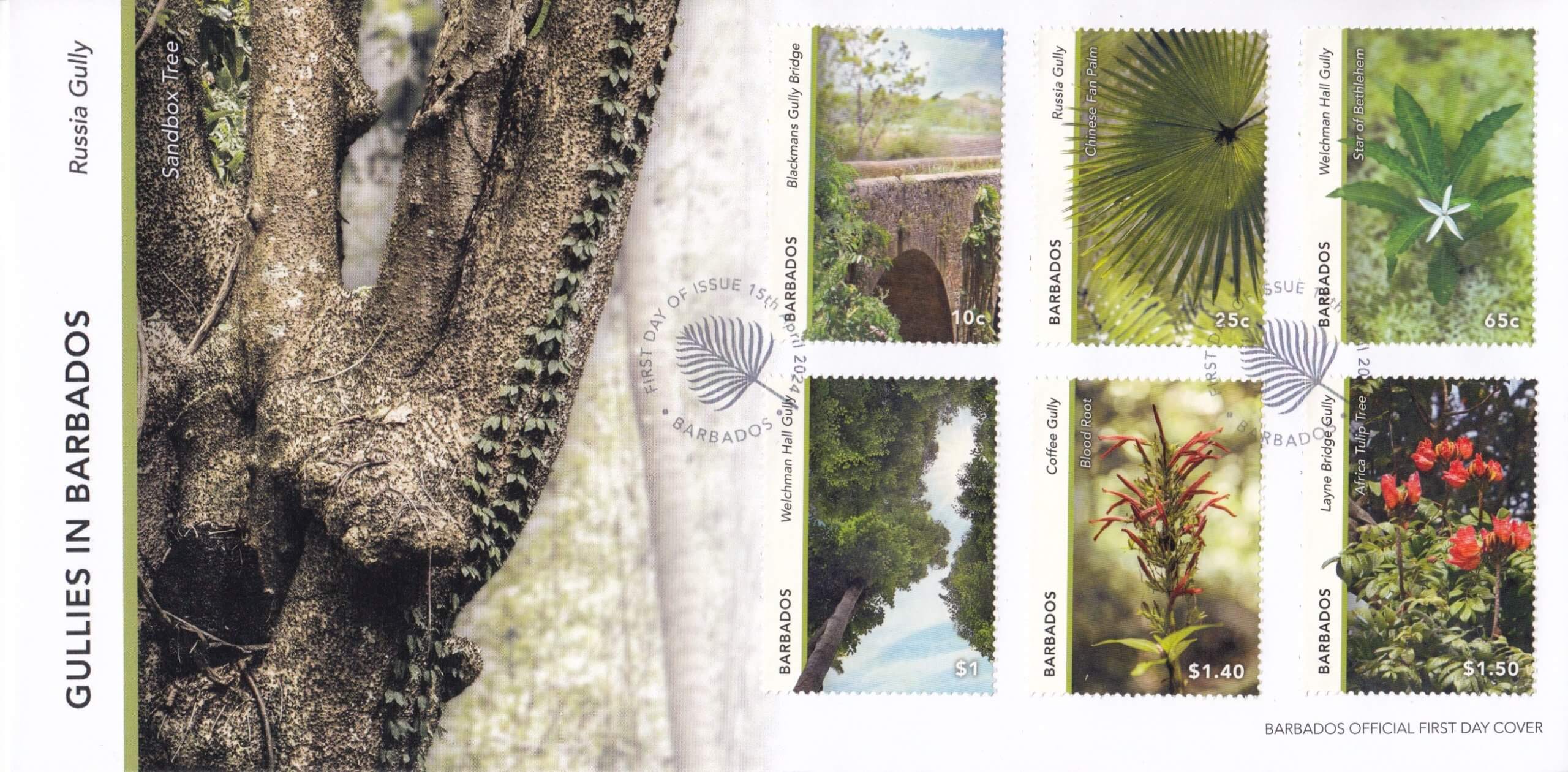
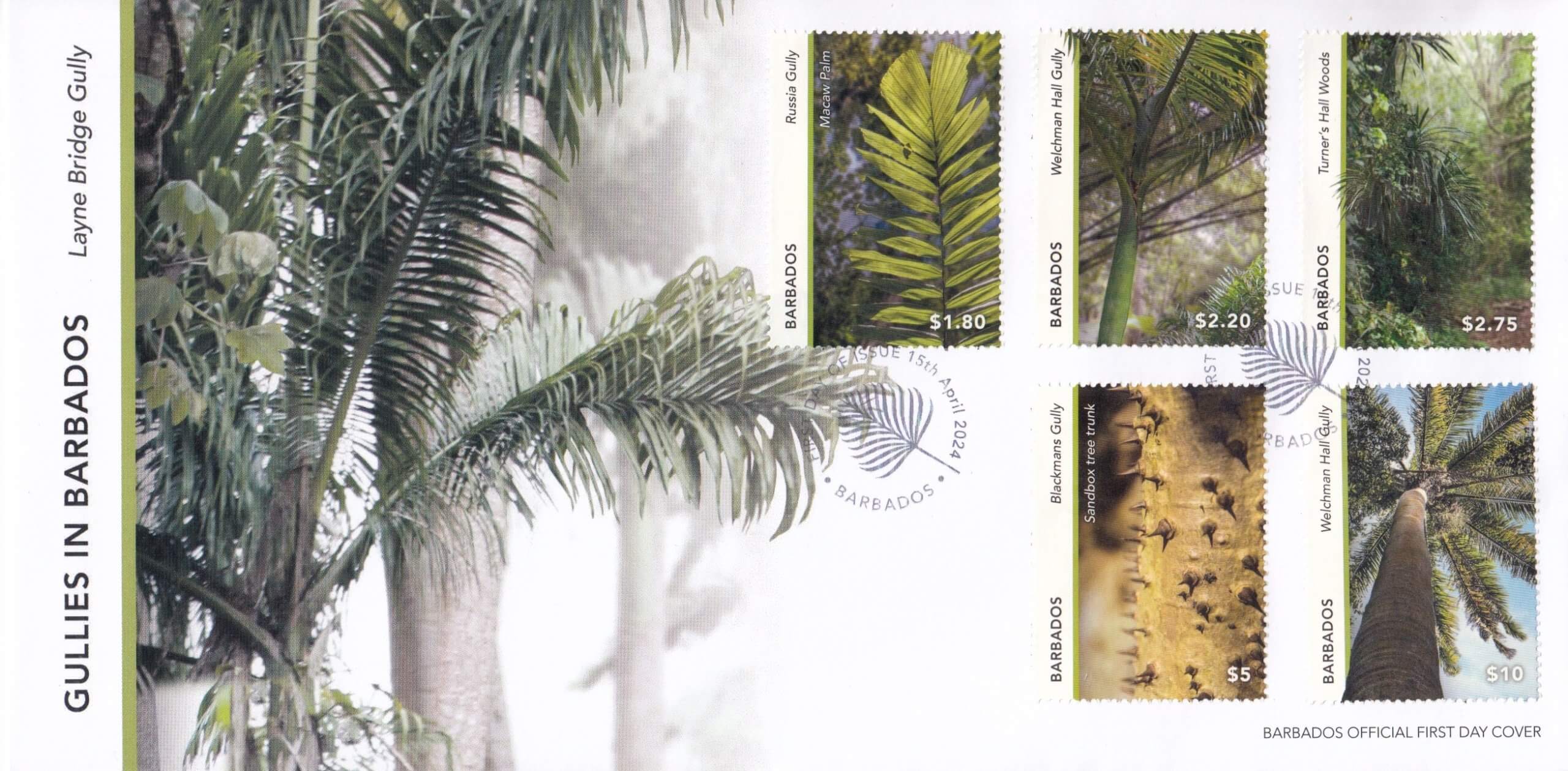
The cancel is a very discreet fern design encircled with the inscription ‘First Day of issue 15th April 2024 – Barbados’.
Verdict
With any new stamp set, there are bound to be a range of views, but I find it hard to be anything other than impressed by this set. The design has been carefully thought through and rather than resorting to what would have been an ‘easy’ option of taking landscape shots of the features, the decision to hone in on some of the details has resulted in a distinctive set of stamps. The addition of the new watermarked paper (CASCO Watermarked) is a nice touch and though hard to see on the stamps, it is simple to view through the selvedge. The stamp size is ideal for most mail situations, though the vertical format might make it slightly harder to use on postcards. Watch out in the future for postcards with stamps affixed sideways as this may well be the norm.
Even though I still think a 5c stamp might be needed, (though this could be picked up on a separate commemorative issue), overall this set gets a huge thumbs up from me as a worthy replacement to the Builders of Barbados set.
References
A to Z of Barbados – Sean Carrington, Henry Fraser, John Gilmore, G. Addinton Forde · 2003
Of Halls, Hills and Holes – Woodville K. Marshall, Patricia Stafford, Karl S. Watson, Tara Inmiss · 2016

[…] how best to photograph these features. Photographing landscapes is relatively straightforward, but gullies are another matter entirely. Many are hidden in dense undergrowth and often in shade for a large […]